Automotive Location Intelligence for Your Next Plant, Plant Expansion or Warehouse
MapZot.AI combines supplier clustering, workforce availability, highway and port access, and market demand into one automotive location intelligence platform built for how OEMs and component makers actually plan sites in India.
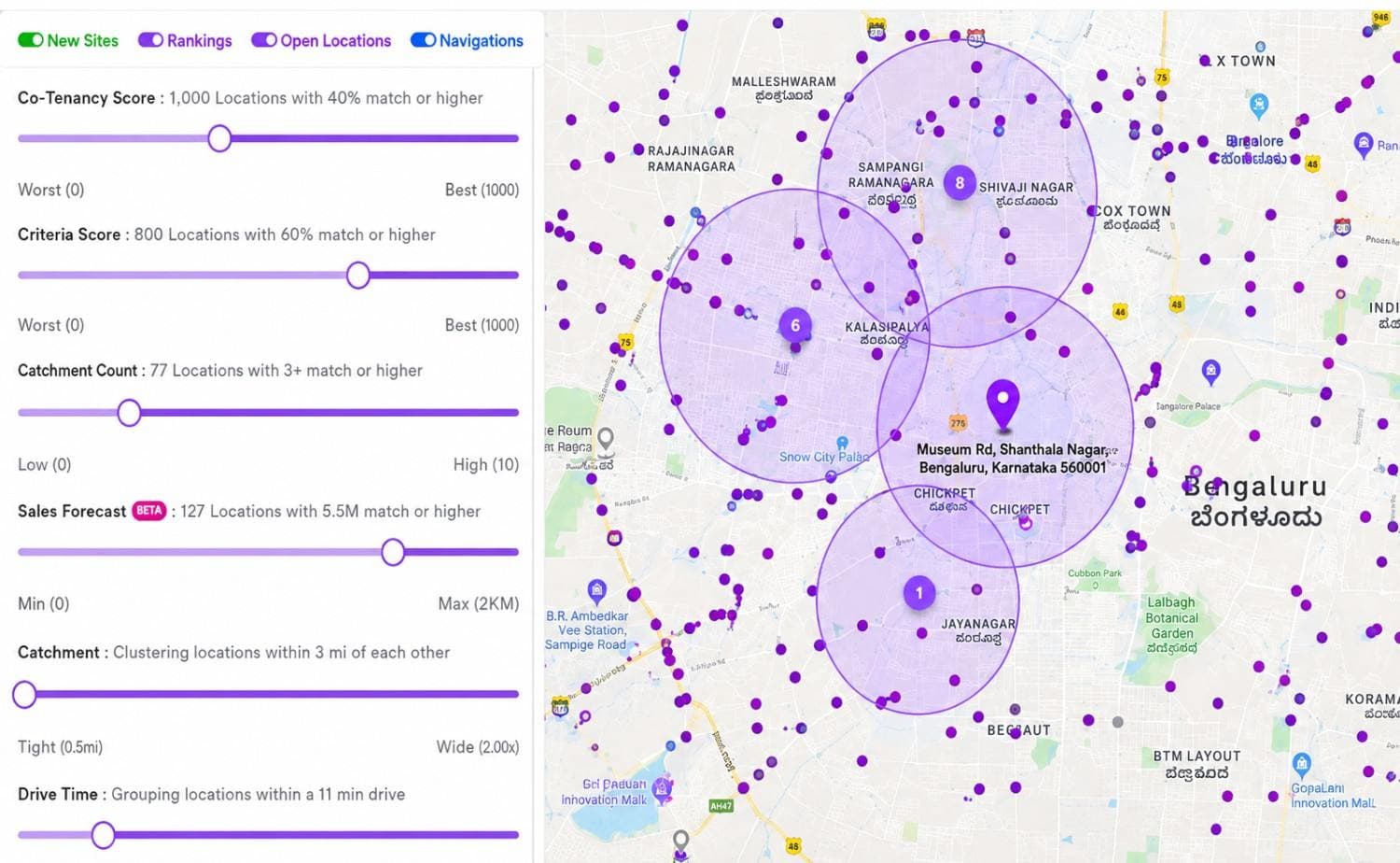
Get a Free DemoStrong OEM proximity, deep supplier ecosystem and NH45 + port connectivity place this site in the top 10% for auto parts manufacturing.
Automotive site decisions carry too much capital risk for guesswork
A plant, warehouse or component facility is a 10-15 year commitment. Choosing the wrong industrial corridor shows up in freight cost, hiring difficulty and supplier lead time for the life of the asset
Automotive market data lives in ten different places
State industrial policies, supplier directories, vehicle registration data and labour statistics are never in one place when a site selection committee needs them.
Supplier and OEM proximity gets mapped on gut feel
Without real automotive location data, teams underestimate freight cost and lead-time risk from being too far from a Tier-1 supplier cluster.
Every new plant or warehouse restarts diligence from zero
An automotive expansion strategy across multiple states means repeating the same manual research each time, with no comparable scoring across sites.
One dashboard for automotive location planning
Search a district, industrial park or coordinates, MapZot.AI overlays supplier clusters, OEM plants, logistics infrastructure and workforce data into a single automotive location analysis
Purpose-built automotive intelligence, not a generic GIS tool
Every layer below is tuned to how OEMs, auto parts manufacturers and warehouse teams actually evaluate an automotive location in India.
Automotive location planning
Screen shortlisted industrial parks and plots against supplier density, workforce and connectivity to find the right automotive location for a plant or facility.
Warehouse site selection
Model drive-time to dealer networks, ports and OEM plants to run warehouse site selection for automotive parts distribution with confidence.
Automotive market analysis
Vehicle registration trends, regional demand and dealership density combine into automotive market intelligence for every state you evaluate.
Supplier & OEM mapping
See every Tier-1, Tier-2 supplier and OEM plant on the map, so auto parts manufacturing sites land inside — not outside — the supply chain.
Expansion strategy
Compare states and industrial corridors on one map to plan a multi-site automotive industry expansion without repeating manual due diligence.
Location data, always current
Live location data on land availability, incentive zones and infrastructure projects keeps every score current as India's industrial map shifts.
From shortlist to site decision in four steps
The same automotive location intelligence workflow whether you're scouting one plot or forty.
Define the search
Search a district, industrial estate, or draw a custom radius around a candidate site.
Layer the data
MapZot.AI overlays supplier clusters, OEM plants, logistics infrastructure and workforce data automatically.
Get your site score
A single score and grade summarise market, supply chain and cost fit for that exact location.
Compare & decide
Stack multiple corridors side by side and export the automotive location analysis for your board.
See where India's automotive manufacturing is actually clustering
From the Chennai-Bengaluru auto corridor to Pune-Chakan and the Delhi-NCR belt, MapZot.AI shows live automotive location data on where OEMs, suppliers and warehousing are concentrating, so your automotive expansion strategy follows the ecosystem, not a hunch.
Ranked corridors by supplier density and OEM proximity Land availability and state incentive zones layered in Built for automotive manufacture in India's key states
FAQs
Recent Publications
Get a free automotive location score for your shortlisted site
Enter a district, industrial park or coordinates and see supplier proximity, logistics access and market data for that exact spot.